

Larkya La Pass Trek: Crossing One of Nepal’s Most Spectacular Himalayan Passes
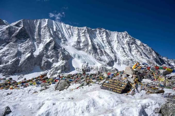
Table of Contents
Few moments in Himalayan trekking match the one at the top of a high pass. You stand among prayer flags in thin, freezing air, and a wall of glaciated peaks fills the horizon. On the Larkya La Pass Trek, that moment arrives at about 5,106 m (some sources and itineraries quote up to 5,160 m), on the far side of the world’s 8th-highest mountain, Mt. Manaslu (8,163 m).
This guide covers the route, the pass-day experience, the best season, permits, costs, packing, and safety. It ends with ten detailed FAQs so that you can plan the trek with confidence.
Larkya La Pass Trek at a Glance
| Detail | Information |
|---|---|
| Trek name | Manaslu Larke Pass Trek (Larkya La Pass Trek) |
| Region | Manaslu Conservation Area, Nepal |
| Highest point | Larkya La Pass, about 5,106 m |
| Start / End | Soti Khola / Dharapani |
| Duration | 14 to 17 days (the listed fixed departures run 17 days) |
| Difficulty | Moderate to challenging; high-altitude pass crossing |
| Best seasons | Spring (Mar–May) and autumn (Sep–Nov) |
| Accommodation | Teahouses and lodges |
| Permits | Manaslu Restricted Area Permit, MCAP, ACAP |
| Guide | Licensed guide mandatory |
You can see the full itinerary, group prices and departure dates on the Manaslu Larkya Pass Trek page from Unique Sherpa Trek & Expedition.
What Is the Larkya La Pass, and Why Is It Famous?
The Larkya La (also spelled Larke La, Larke Pass, or Larkya Pass) is the high point of the classic Manaslu Circuit. It links the upper Budhi Gandaki valley, where villages show strong Tibetan influence, with the Marsyangdi valley on the Annapurna side.
It earns its reputation for several reasons:
- The scale of the crossing. It is a long, high day with a steady climb over moraine and snow, followed by a descent of more than 1,300 m.
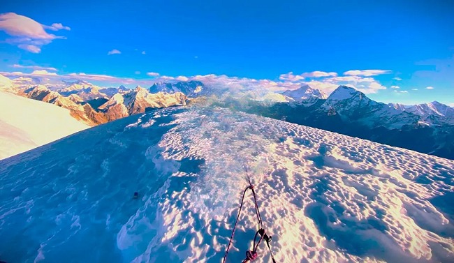
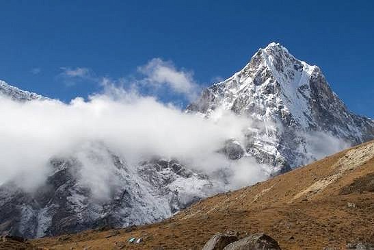
- The panorama. From the top, you look across to Manaslu, Himlung Himal, Cheo Himal, Kang Guru and Annapurna II.
- The remoteness. Because Manaslu is a restricted area, the trails are quieter than Everest or Annapurna.
- The contrast. You move from dry, Tibetan-style high villages on one side to green alpine meadows at Bimthang on the other.
Route Overview: From Soti Khola to Dharapani
The trek follows the Budhi Gandaki River upstream, climbs to Samagaun and Samdo beneath Manaslu, crosses the pass, and then drops to Bimthang and the Marsyangdi valley.
The Lower Valley (about 800–2,660 m)
The trek begins with a long drive from Kathmandu to Soti Khola, followed by days through subtropical forest, terraced farmland, suspension bridges and waterfalls. Villages like Machha Khola, Jagat and Deng show the Gurung and Magar side of the valley. Expect warm, humid weather and steady climbing.
The Middle Valley (Namrung, Lho, Samagaun)
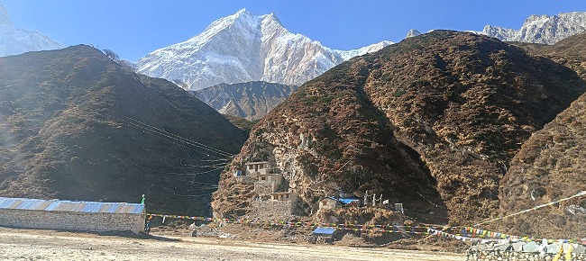
Above Namrung, the landscape opens up. Houses become stone and Tibetan-style, mani walls line the trail, and Manaslu appears for the first time. Samagaun (3,530 m) is the big acclimatization base, with options to hike to Birendra Lake or the Manaslu Base Camp area, and to visit Pungyen Gompa.
The High Zone (Samdo and Dharamsala)
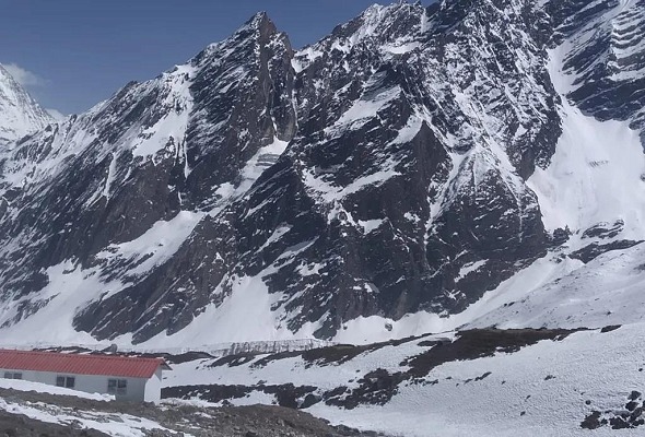
Beyond Samagaun, the air thins and trees disappear. Samdo (3,860 m) is a high settlement close to the Tibetan border, and Dharamsala (Larke Phedi) is the final stop before the pass. Different sources list its altitude differently, from roughly 4,460 m to 4,880 m, so ask your guide for the exact figure on your itinerary.
The Descent (Bimthang and Dharapani)
After the pass, you drop to Bimthang (3,720 m), a wide glacial basin with views of Manaslu’s south side, then descend through forest to Dharapani (about 1,860 m) and drive to Kathmandu via Besisahar.
Pass Day: What Crossing Larkya La Really Feels Like
Pass day is the longest and hardest day of the trek. A typical day looks like this:
- Before dawn (around 3:30-5:00 am). You eat breakfast by headlamp and set off in freezing air from Dharamsala.
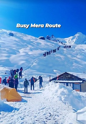
- The climb (about 3-4 hours). The trail follows a rocky, moraine-strewn path, passing frozen lakes and then climbing steadily toward the pass. Pace is slow and deliberate.
- The summit. Prayer flags flutter in the wind, and you get a few minutes to take photos before the cold and wind drive you onward.
- The descent. A steep descent over loose stones and sometimes snow or ice leads down the Bimthang side. It is long, hard on the knees, and easy to underestimate.
- Arrival at Bimthang (8-10 hours total). You arrive tired and happy at a warm teahouse.
Keep your down jacket, gloves, hat, sunglasses, water, and snacks in your daypack, so you can reach them easily. Trekking poles help on the descent, and gaiters or microspikes may be needed if there is fresh snow or ice, so check with your guide the evening before.
Best Time for the Larkya La Pass Trek
| Season | Months | Conditions |
|---|---|---|
| Autumn | Sep – Nov | Clear skies, stable weather, dry trails; October is generally the most reliable month |
| Spring | Mar – May | Rhododendron bloom, warmer valleys, good visibility; some snow remains early in the season |
| Winter | Dec – Feb | Very cold, heavy snow, high risk of closure; experienced trekkers only |
| Monsoon | Jun – Aug | Rain, landslides, leeches and cloud; not recommended |
The operator’s page lists fixed departures from October to December 2026 and into January 2027, all at the same price. Since Larkya La can close in deep winter, the autumn and spring seasons are the safest bets for the crossing. For a month-by-month look at temperatures and snow, see our Manaslu weather guide (replace with your own weather post link if you prefer).
How Hard Is the Larkya La Pass Trek?
The trek is rated moderate to challenging. It needs no technical climbing skill, but several things add up:
- Duration and distance: many days of 5 to 8 hours of walking, with pass day running 8 to 10 hours
- Altitude: the trail climbs above 5,000 m after several days above 3,500 m
- Cold: nights below freezing at Samdo and Dharamsala
- Remoteness: limited facilities and slower evacuation than on busier routes
Start training 8 to 12 weeks beforehand. Build cardio with hiking, cycling or running, add stair climbing, and do some long days with a loaded pack. Previous trekking experience at altitude helps a great deal.
Altitude and Acclimatization
The itinerary builds in two acclimatization days at Samagaun (3,530 m), with hikes such as the Birendra Lake side trip or the Manaslu Base Camp area. Follow these rules to stay safe:
- Walk slowly and avoid rushing.
- Drink plenty of water (about 3-4 litres a day).
- Avoid alcohol and sleeping pills at altitude.
- Learn the early symptoms of AMS (headache, nausea, dizziness, poor sleep) and tell your guide at once.
- Ask your doctor about medication before you travel.
- Descend if symptoms worsen, because descending is the cure.
Permits for the Larkya La Pass Trek
Manaslu is a restricted area, so you cannot trek it independently. You need:
| Permit | Typical cost |
|---|---|
| Manaslu Restricted Area Permit (RAP) | USD 100 for the first 7 days in Sep–Nov (USD 75 in Dec–Aug), plus extra per day |
| Manaslu Conservation Area Permit (MCAP) | About USD 20 |
| Annapurna Conservation Area Permit (ACAP) | About USD 20 |
All of these are arranged in Kathmandu through a registered trekking agency, and a licensed guide is mandatory. In the Unique Sherpa package, the restricted area permit, conservation permits, and applicable registration fees are included. Rules and fees change, so for current figures, check the operator’s permit articles on Trekking Permit Fees in Nepal and Nepal Trekking Permits & Visa 2026.
Larkya La Pass Trek Cost
The listed price for the 14-day Manaslu Larke Pass Trek on the operator’s page is US$1,650 per person, with group-size pricing:
| Group size | Price per person |
|---|---|
| 1-2 people | US$1,750 |
| 3-10 people | US$1,640 |
| 11-20 people | US$1,550 |
Included in the package:
- Kathmandu airport transfers and 2 nights in a Kathmandu hotel on bed and breakfast
- Private transport for the Kathmandu-Manaslu-Kathmandu road journeys
- Three meals a day on the trek, tea or coffee with meals and seasonal fruit after dinner
- Teahouse accommodation, a licensed guide, an assistant guide and porters according to group size
- Manaslu Restricted Area Permit, MCAP, ACAP and other required permits and fees
- Staff wages and insurance, a waterproof duffel bag, a first-aid kit and a farewell dinner
Not included:
- International flights and the Nepal visa fee
- Travel and evacuation insurance
- Lunch and dinner in Kathmandu
- Personal expenses (Wi-Fi, charging, hot showers, laundry, drinks)
- Tips for guides and porters
- Extra costs from delays, weather, landslides, or early return
Prices can change, so check the trip page for current rates and fixed dates.
Day-by-Day Itinerary Summary
| Day | Route | Altitude |
|---|---|---|
| 1 | Arrive in Kathmandu | 1,400 m |
| 2 | Sightseeing, permits and gear check | 1,400 m |
| 3 | Drive to Soti Khola | 800 m |
| 4 | Trek to Machha Khola | 850 m |
| 5 | Trek to Jagat | 1,350 m |
| 6 | Trek to Deng | 1,860 m |
| 7 | Trek to Namrung | 2,660 m |
| 8 | Trek to Lho | 3,180 m |
| 9 | Trek to Samagaun | 3,530 m |
| 10 | Acclimatization day at Samagaun | 3,530 m |
| 11 | Hike toward Manaslu Base Camp area | Up to the high point of the side trip |
| 12 | Trek to Samdo | 3,860 m |
| 13 | Trek to Dharamsala (Larke Phedi) | about 4,460-4,880 m |
| 14 | Cross Larkya La Pass, descend to Bimthang | 5,106 m / 3,720 m |
| 15 | Trek to Dharapani | 1,860 m |
| 16 | Drive to Kathmandu via Besisahar | 1,440 m |
| 17 | Departure | - |
The trip page headline says 14 days, while the fixed departures and day-by-day plan run 17 days, including Kathmandu and drive days. Confirm the final schedule with your operator.
What to Pack for the Larkya La Pass Trek
Temperatures swing from warm valleys to well below freezing, so use a layering system:
Thermal base layer → fleece mid-layer → down jacket → waterproof and windproof shell
Essentials:
- Waterproof, broken-in trekking boots with ankle support
- Warm hat, liner gloves and insulated gloves or mittens
- Sleeping bag rated -10°C to -15°C, plus a liner
- Trekking poles, a headlamp with spare batteries, sunglasses (UV-protective) and SPF 30-50+ sunscreen
- Gaiters and microspikes if snow or ice is expected
- Water bottles (2-3 litre capacity) and purification tablets or a filter
- A personal first-aid kit, your regular medication and travel insurance documents
- A power bank, a waterproof phone pouch and warm layers for the pass-day daypack
Culture, Wildlife and Landscapes
The Larkya La route is not just about the pass. Along the way you will find:
- Tibetan Buddhist culture: mani walls, chortens, prayer wheels and monasteries such as Pungyen Gompa near Samagaun
- Communities: Gurung, Magar, Tamang and Tibetan-descended villagers
- Wildlife: Himalayan tahr, blue sheep, musk deer and Himalayan monal, with snow leopards and red pandas living in the protected area (sightings are rare)
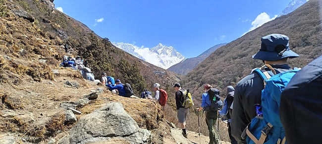
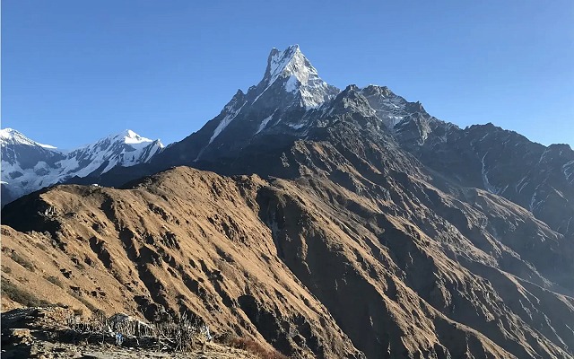
- Scenery: subtropical gorges, rhododendron and pine forest, glacial valleys and alpine meadows
Respect local customs: walk clockwise around mani walls and chortens, ask before photographing people, and keep monastery areas quiet.
Larkya La vs. Other Famous Himalayan Passes
| Pass | Region | Highest point | Character |
|---|---|---|---|
| Larkya La | Manaslu | about 5,106 m | Remote, cultural, quieter trails |
| Thorong La | Annapurna Circuit | about 5,416 m | More popular, easier logistics |
| Cho La | Everest | about 5,420 m | Glacier crossing, shorter pass |
| Kongma La | Everest | about 5,535 m | High pass on the Three Passes route |
If you’re weighing options, compare the Larkya La route with the operator’s Annapurna Circuit Trek, Gokyo Cho-La Pass Trek or Everest Three High Passes Trek. Larkya La stands out for fewer crowds and strong cultural depth.
Add-Ons and Alternatives
- Shorter loop: the Manaslu Circuit Trek (12 days) covers the same loop on a compressed schedule.
- Cultural extension: combine the pass with the Manaslu Tsum Valley Trek for a sacred hidden valley.
- Guide and porter only: if you have your own plans, see the operator’s guide/porter hire option for Manaslu trekking.
Safety Tips for the Pass Crossing
- Start early. Wind and snow conditions usually worsen later in the day.
- Keep your pace steady. Don’t race, even if you feel strong.
- Eat and drink on the move. Carry snacks and an insulated bottle so water doesn’t freeze.
- Follow your guide’s call. Pass crossings can be delayed or cancelled for weather or snow.
- Build in a buffer day. Delays happen, so don’t schedule your flight home for the day after you return.
- Buy proper insurance. It should cover high-altitude trekking and helicopter evacuation, with the policy wording checked against the pass altitude.
Top 10 FAQs: Larkya La Pass Trek (Manaslu Larke Pass Trek)
1. How high is Larkya La Pass, and how difficult is the crossing?
Larkya La is commonly given as about 5,106 m (16,752 ft), though some operators and the trip page itself also quote 5,160 m, so you may see both figures. The crossing is the hardest day of the trek: you leave Dharamsala before dawn, climb for several hours over moraine and snow, then descend a long way to Bimthang, usually 8 to 10 hours in total.
It needs no technical climbing, but it does demand strong fitness, warm clothing, and good acclimatization. If you have trekked above 4,000 m before and prepared well, it is achievable for most healthy trekkers. Weather can delay or cancel a crossing, so allow a buffer day.
2. What is the best time to do the Larkya La Pass Trek?
The best seasons are autumn (September to November) and spring (March to May). Autumn gives clear skies, stable weather, and dry trails, and October is often the most reliable month. Spring brings rhododendron blooms and warmer valley days, though snow may linger higher up in early spring.
Winter (December to February) is possible but cold, with a risk of heavy snow closing the pass. The monsoon (June to August) brings rain, landslides, and leeches, and is not recommended. The operator lists fixed departures between October 2026 and January 2027.
3. How many days does the trek take, and what is the daily walking time?
The trek takes 14 to 17 days depending on the itinerary. The page headline mentions 14 days, while the fixed departures and the full plan show 17 days, including Kathmandu arrival, sightseeing, the drive to Soti Khola, two acclimatization days, and the drive back from Dharapani.
Daily trekking usually runs 5 to 8 hours, and pass day takes 8 to 10 hours. Rest and acclimatization days at Samagaun break up the effort. Confirm the exact schedule when you book.
4. What permits do I need, and can I go without a guide?
You need a Manaslu Restricted Area Permit (RAP), a Manaslu Conservation Area Permit (MCAP), and an Annapurna Conservation Area Permit (ACAP) for the descent into the Marsyangdi valley. Typical fees are USD 100 for the RAP’s first 7 days in September to November (USD 75 from December to August) plus a per-day fee after that, and about USD 20 each for the MCAP and ACAP.
You cannot trek independently. A licensed guide and registered agency are mandatory, and permits are issued only through them. In the Unique Sherpa package, these permits and the applicable fees are included. Fees and rules can change, so confirm current figures before booking.
5. How much does the trek cost, and what is not included?
The listed price is US$1,650 per person, with group pricing of US$1,750 for 1-2 people, US$1,640 for 3-10 people and US$1,550 for 11-20 people. It includes airport transfers, 2 hotel nights in Kathmandu with breakfast, private road transport, three meals a day on the trek, teahouse accommodation, a licensed guide, assistant guide and porters by group size, permits, staff insurance, a waterproof duffel bag and a farewell dinner.
It excludes international flights, the visa, travel and evacuation insurance, Kathmandu lunches and dinners, personal expenses, tips, and extra costs from delays, landslides, weather or early return. Always ask for a written inclusions list before you pay.
6. How do I prevent altitude sickness on the pass?
The route includes two acclimatization days at Samagaun (3,530 m), with hikes to higher points before returning to sleep low. To reduce risk:
- Ascend gradually and keep a slow pace.
- Drink 3-4 litres of water a day and eat regularly.
- Avoid alcohol and sleeping pills.
- Report headaches, nausea, dizziness or breathlessness to your guide immediately.
- Talk to your doctor about medication before you travel.
- Descend if symptoms get worse.
Because the pass is long, don’t attempt it if you feel unwell. Your guide may delay the crossing to give you another night to adjust.
7. What is the accommodation and food like on the trek?
You stay in teahouses and lodges, usually in twin-sharing rooms with simple beds and blankets, plus a shared dining room. Higher up, rooms are colder and more basic, so a warm sleeping bag matters.
The package includes three meals a day, tea or coffee with meals, and fruit after dinner. Menus typically feature dal bhat, noodle soups, pasta, Tibetan bread, momos, potatoes, and eggs. Wi-Fi, hot showers and device charging may cost extra, and phone coverage gets patchy above Samagaun.
8. What should I pack, and what gear is essential for the pass day?
The core kit is waterproof trekking boots, thermal base layers, a fleece, a down jacket, a waterproof and windproof shell, a warm hat, liner gloves and insulated gloves, a -10°C to -15°C sleeping bag, trekking poles, a headlamp, sunglasses, sunscreen, a water bottle, water purification, and a first-aid kit.
For the pass day, keep your down jacket, warm gloves, hat, sunglasses, headlamp, water, and snacks in your daypack. Gaiters help in snow and mud, and microspikes may be needed depending on conditions, so ask your guide the night before. The operator’s trip page includes a long equipment checklist.
9. What are the main risks, and what safety measures are in place?
The main risks are altitude sickness, cold, snow or ice on the pass, trail hazards from landslides in the lower valley, and the remoteness of the region. Reasonable precautions include:
- Travelling with a licensed, experienced guide who monitors your health daily
- Building acclimatization days into the schedule
- Carrying a first-aid kit and having an emergency evacuation plan
- Starting pass day early and following the guide’s decision on whether to cross
- Holding insurance that covers high-altitude trekking and helicopter evacuation
Check the operator’s travel and safety updates, such as its Nepal Travel Update 2026 page, before you travel for any local trail or road conditions.
10. How do I get to the trailhead, and how do I book?
The trek starts at Soti Khola, reached by a private vehicle drive from Kathmandu of roughly 7 to 8 hours over 160-170 km, with some rough sections after Arughat. It finishes at Dharapani in the Marsyangdi Valley, followed by a drive to Kathmandu via Besisahar of 7 to 9 hours. Road conditions can change with weather and landslides, so keep a spare day at the end.
To book, choose a fixed departure or ask for a private date, send your passport details, and pay the required deposit. The operator lists many departures between October 2026 and January 2027, and you can view dates and book on the Manaslu Larkya La Pass Trek page or contact the team.
Ready to Cross Larkya La?
The Larkya La Pass Trek rewards patience and preparation with one of the best high-pass experiences in Nepal: towering peaks, quiet trails, deep Tibetan culture and a sense of real wilderness. Choose your season, train well, pack for the cold, and let your guide set the pace.
Explore the Manaslu Larke Pass Trek for the full itinerary, group pricing, and current fixed departures, or message the team on WhatsApp at +977 9862854770 for a custom plan.
Disclaimer: Altitudes, permit fees, and trail conditions vary by source and season. Figures here are for planning only, so confirm current details with your operator before booking.
.jpg)