


Gokyo Cho La Pass Trek Altitude & Elevation Guide
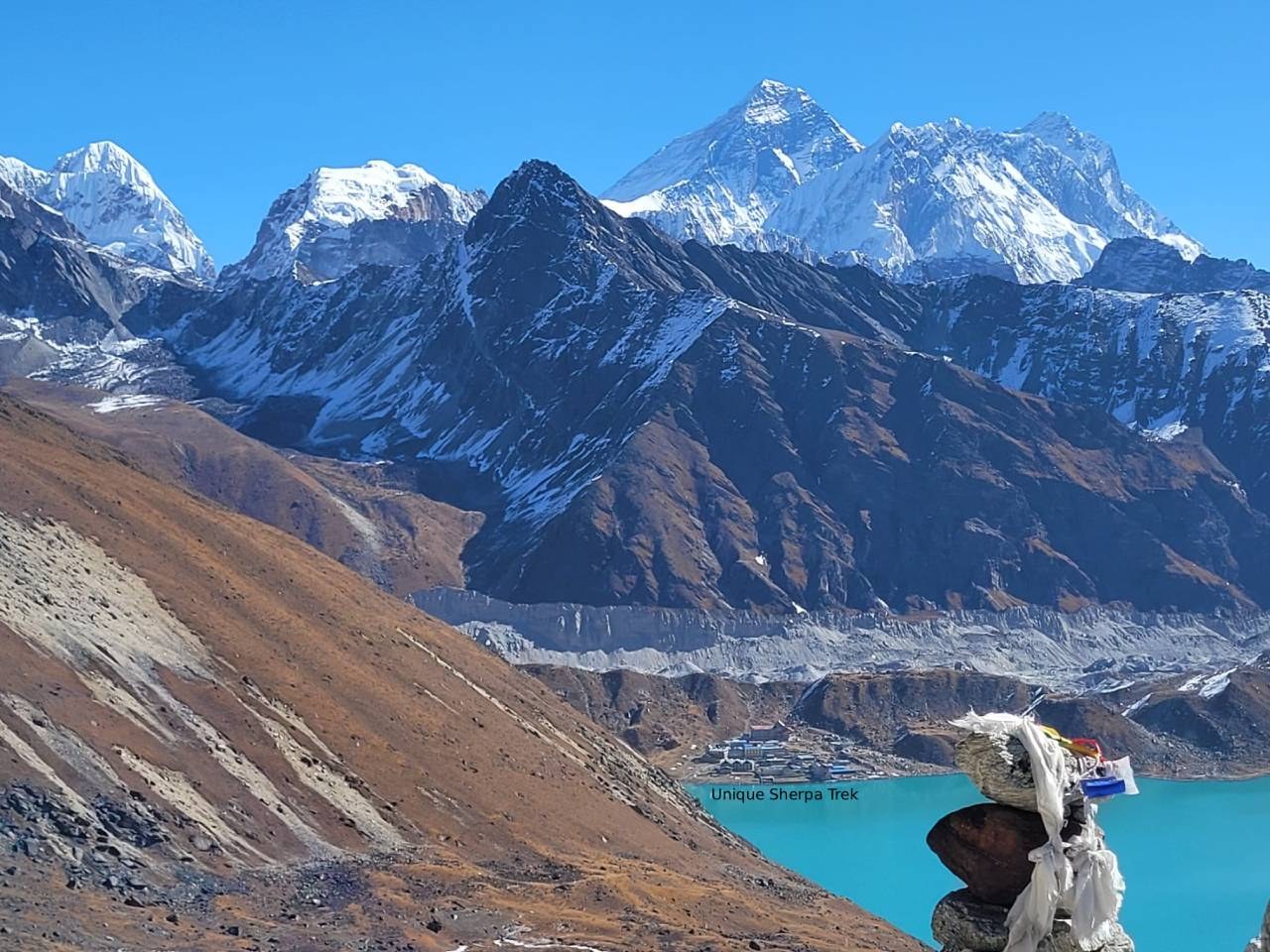
Table of Contents
The Gokyo Cho La Pass Trek is one of the most complete high-altitude adventures in the Everest region — a single circular route that strings together the turquoise Gokyo Lakes, Nepal's longest glacier, the classic Everest Base Camp trail, and one of the Khumbu's most dramatic passes. Most itineraries run 15 to 17 days, starting with the short mountain flight into Lukla and finishing with three separate crossings above 5,300 meters in a single week: Gokyo Ri, Cho La Pass, and finally Kala Patthar.
The Gokyo Cho La Pass Trek altitude reaches its highest point at Kala Patthar, 5,545 meters (18,192 ft), though the trek's defining challenge is Cho La Pass, 5,420 meters (17,782 ft) — a glaciated crossing linking the Gokyo Valley to the Everest Base Camp trail. At these elevations, the air holds roughly half the oxygen available at sea level.
Unlike a straight there-and-back trek to Base Camp, this route loops through two separate high valleys, which means trekkers spend an unusually long stretch of days living and sleeping above 4,000 meters. That's precisely why the itinerary is built the way it is — gradual elevation gain through Namche Bazaar, Dole, and Machhermo, a full day at Gokyo for lake exploration and the Gokyo Ri sunrise climb, then the technical high point of the trip: the Cho La crossing itself, before rejoining the Everest Base Camp trail through Lobuche, Gorak Shep, and Kala Patthar.
This guide walks through exactly where the elevation climbs fastest, where altitude sickness risk rises across this longer high-altitude circuit, and how to prepare so the Cho La crossing feels like the trip's highlight rather than its biggest hurdle.
What Is the Highest Point on the Gokyo Cho La Pass Trek?
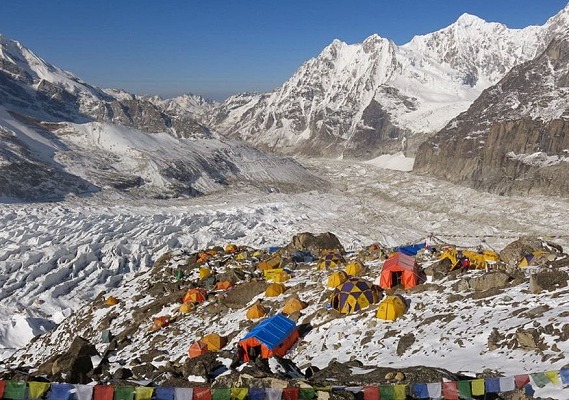
Technically, the highest point most trekkers reach is Kala Patthar, at 5,545 meters (18,192 feet) — the iconic sunrise viewpoint above Gorak Shep with the closest trekking view of Everest's summit pyramid. But the trek's real defining challenge is Cho La Pass, at 5,420 meters (17,782 feet), a glaciated, boulder-strewn crossing between the Gokyo Valley and the village of Dzongla on the Everest Base Camp side.
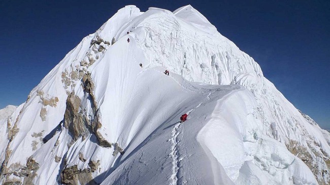
It's worth understanding the difference between the two: Kala Patthar is a straightforward (if steep and breathless) viewpoint climb from a fixed overnight base, while Cho La is an actual mountain pass crossing — several hours of glacier travel, loose rock, and snow or ice depending on the season, tackled in one long push from Thangnak to Dzongla. Along the way, the route also summits Gokyo Ri (5,357 m) for a 360-degree panorama over the Gokyo Lakes and Ngozumpa Glacier, and passes through Everest Base Camp itself (5,364 m) before the final Kala Patthar climb — meaning trekkers cross four separate points above 5,300 meters in the space of roughly a week.
That combination — three high viewpoints plus a genuine glacial pass, all within one continuous circuit — is what makes this route noticeably more demanding, altitude-wise, than either the standalone Everest Base Camp trek or the standalone Gokyo Lakes trek on their own.
Gokyo Cho La Pass Trek Elevation Profile
A standard itinerary begins with a mountain flight from Kathmandu to Lukla, follows the Dudh Koshi valley to Namche Bazaar, then branches west into the quieter Gokyo Valley before crossing Cho La to rejoin the main Everest Base Camp trail. Here's the elevation profile of the key stops along the route:
| Location | Altitude (Meters) | Altitude (Feet) | Notes |
|---|---|---|---|
| Kathmandu | 1,400 | 4,593 | Arrival point before the flight to Lukla. |
| Lukla | 2,860 | 9,383 | Mountain airstrip; trek starts and ends here. |
| Phakding | 2,610 | 8,563 | First overnight; gentle warm-up day. |
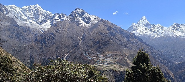
| Namche Bazaar | 3,440–3,460 | 11,286–11,352 | Sherpa hub; first major acclimatization stop. |
| Dole | 4,200 | 13,779 | First high-altitude village in the Gokyo Valley. |
| Machhermo | 4,460 | 14,633 | Quiet stop with views of Cho Oyu and Kantega. |
| Gokyo | 4,790 | 15,715 | Base for the Gokyo Lakes and Gokyo Ri climb. |
| Gokyo Ri | 5,357 | 17,575 | Sunrise viewpoint over the Gokyo Valley. |
| Thangnak | 4,780 | 15,682 | Staging point before the Cho La crossing. |
| Cho La Pass | 5,420 | 17,782 | Highest pass crossing on the route. |
| Dzongla | 4,940 | 16,207 | First stop after descending from Cho La. |
| Lobuche | 4,910 | 16,109 | Rejoins the classic Everest Base Camp trail. |
| Gorak Shep | 5,160 | 16,929 | Final overnight before Base Camp and Kala Patthar. |
| Everest Base Camp | 5,364 | 17,598 | Foot of the Khumbu Icefall. |
| Kala Patthar | 5,545 | 18,192 | Highest point reached on the entire trek. |
Day-by-Day Elevation Gain on the Gokyo Cho La Pass Trek
Elevation on this route climbs in two distinct phases — a steady build through the Gokyo Valley, then a demanding high-altitude traverse across Cho La before rejoining the Everest Base Camp trail. The table below reflects a standard 16–17 day itinerary starting and ending in Kathmandu.
| Day | Trekking Route | Elevation | Net Elevation Change |
|---|---|---|---|
| Day 1 | Arrival in Kathmandu | 1,400 m | — |
| Day 2 | Fly to Lukla, trek to Phakding | 2,610 m | +1,210 m (mostly by air) |
| Day 3 | Trek to Namche Bazaar | 3,440 m | +830 m |
| Day 4 | Acclimatization in Namche (day hike higher) | 3,440 m | 0 m (day hike to ~3,880 m) |
| Day 5 | Trek to Dole | 4,200 m | +760 m |
| Day 6 | Trek to Machhermo | 4,460 m | +260 m |
| Day 7 | Trek to Gokyo | 4,790 m | +330 m |
| Day 8 | Climb Gokyo Ri, return to Gokyo | 5,357 m → 4,790 m | +567 m to summit, then descend |
| Day 9 | Trek to Thangnak | 4,780 m | -10 m |
| Day 10 | Cross Cho La Pass to Dzongla | Pass: 5,420 m Dzongla: 4,940 m | +640 m to pass; -480 m to Dzongla |
| Day 11 | Trek to Lobuche | 4,910 m | -30 m |
| Day 12 | Trek to Gorak Shep, hike to Everest Base Camp | 5,160 m / 5,364 m | +250 m to Gorak Shep, +204 m to Base Camp |
| Day 13 | Hike to Kala Patthar, descend to Pheriche | 5,545 m → 4,340 m | +385 m to summit, -1,205 m to Pheriche |
| Day 14–15 | Trek back to Namche, then to Lukla | 3,440 m → 2,860 m | Steady descent |
| Day 16 | Fly back to Kathmandu | 1,400 m | -1,460 m (by air) |
Gokyo Cho La Pass Altitude Compared to Everest Base Camp and Annapurna Circuit
Trekkers weighing this route against Nepal's other major high-altitude circuits will find it sits at the demanding end of the scale — and for good reason, since it effectively combines two high-altitude treks into one.
| Point | Gokyo Cho La Pass Trek | Everest Base Camp Trek | Annapurna Circuit Trek |
|---|---|---|---|
| Highest Point | 5,545 m (18,192 ft) at Kala Patthar | 5,545 m (18,192 ft) at Kala Patthar | 5,416 m (17,769 ft) at Thorong La |
| Highest Pass Crossing | 5,420 m (17,782 ft) at Cho La | — (no pass crossing) | 5,416 m (17,769 ft) at Thorong La |
| Points Above 5,300 m | Four (Gokyo Ri, Cho La, Base Camp, Kala Patthar) | One (Kala Patthar) | One (Thorong La) |
| Trek Duration | 15–17 days | 12–15 days | 12–16 days |
| Acclimatization | Namche + gradual Gokyo Valley ascent | Namche and Dingboche | One rest day in Manang |
| Oxygen Level (approx.) | Roughly 50% of sea level | Roughly 50% of sea level | Roughly 50% of sea level |
| Altitude Sickness Risk | High, sustained across multiple high days | High, spread across several high nights | High, concentrated on pass-crossing day |
What sets this trek apart isn't any single elevation record — Cho La and Kala Patthar are both slightly below Thorong La's highest reported figures — but the sheer number of consecutive days spent above 4,700 meters, crossing four separate high points rather than just one. That cumulative exposure is why the itinerary runs longer than a standard Everest Base Camp trek and why acclimatization planning matters even more here.
How Does the Gokyo Cho La Pass Trek Compare to Other Himalayan Treks?
Among Nepal's classic high-altitude routes, Cho La and Kala Patthar both sit firmly in the "extreme altitude" bracket, alongside the Khumbu's other major passes and base camps.
| Trek / Point | Highest Point | Difference from Kala Patthar (5,545 m) | Altitude Category |
|---|---|---|---|
| Gokyo Cho La Pass (Kala Patthar) | 5,545 m | — | Extreme |
| Poon Hill | 3,210 m | -2,335 m | Beginner |
| Annapurna Base Camp | 4,130 m | -1,415 m | Moderate |
| Langtang (Tserko Ri) | 4,984 m | -561 m | Very High |
| Manaslu Circuit (Larkya La) | 5,160 m | -385 m | Extreme |
| Kanchenjunga Base Camp | Approx. 5,140 m | -405 m | Extreme |
| Annapurna Circuit (Thorong La) | 5,416 m | -129 m | Extreme |
| Cho La Pass (this trek) | 5,420 m | -125 m | Extreme |
| Gokyo Ri (this trek) | 5,357 m | -188 m | Extreme |
| Everest Base Camp | 5,364 m | -181 m | Extreme |
Shorter, lower routes suit trekkers with limited time or altitude experience, but for those who've already done a standard Everest Base Camp or Gokyo Lakes trek and want the complete Khumbu experience in one journey — glacial lakes, a genuine pass crossing, and the world's highest mountain — few routes in Nepal pack in as much high-altitude terrain as this one.
Does Altitude Sickness Affect the Gokyo Cho La Pass Trek?
Yes — and given how many consecutive days this trek spends above 4,000 meters, altitude sickness is a more sustained concern here than on many other Everest region routes. Trekkers sleep above 3,500 meters for well over a week and cross above 5,000 meters on at least three separate days (Gokyo Ri, Cho La, and the Base Camp/Kala Patthar push), putting everyone at meaningful risk of Acute Mountain Sickness (AMS).
Risk rises noticeably from Dole onward and stays elevated through the Gokyo Valley, peaking again on Cho La crossing day and during the final Gorak Shep push. Common symptoms include headache, nausea, dizziness, fatigue, loss of appetite, and poor sleep. Left unaddressed, these can progress toward High-Altitude Pulmonary Edema (HAPE) or High-Altitude Cerebral Edema (HACE), both of which require immediate descent.
Fitness alone doesn't prevent AMS — strong trekkers sometimes move too fast simply because they're capable of it, which raises risk rather than lowering it. Ascent rate, hydration, rest, and honest symptom-monitoring matter far more than cardio fitness. Given the trek's remote sections around Thangnak and Dzongla, where rescue response can take longer than on the busier main Everest Base Camp trail, comprehensive travel insurance covering high-altitude helicopter evacuation is essential.
Gokyo Cho La Pass Acclimatization
A properly built itinerary includes a dedicated acclimatization day in Namche Bazaar (3,440 m), followed by a naturally gradual climb through Dole, Machhermo, and Gokyo that spreads elevation gain across several manageable days rather than compressing it. The full day at Gokyo (4,790 m) — used for the Gokyo Ri sunrise climb and lake exploration — doubles as an extra buffer for the body to adjust before the Cho La crossing.
The single hardest day on the entire trek is the crossing from Thangnak over Cho La Pass to Dzongla — roughly 640 meters of ascent over glacier and loose rock, followed by a steep descent, all above 4,700 meters. A slow, deliberate pace and an early start (to avoid afternoon winds and softening snow) matter more here than almost anywhere else on the route.
If you'd like extra buffer built into your schedule — particularly useful for first-time high-altitude trekkers — Unique Sherpa Trek & Expedition can customize your Gokyo Cho La Pass Trek itinerary with additional rest days around Namche or Gokyo.
How Difficult Is the Gokyo Cho La Pass Trek Because of Altitude?
The Gokyo Cho La Pass Trek is graded moderate to adventure, and its extended time at extreme altitude is the main reason why:
- Kala Patthar and Cho La both sit above 5,400 meters, where oxygen levels are roughly half of sea level — even a slow pace leaves most trekkers breathing hard.
- The trek involves four separate climbs above 5,300 meters (Gokyo Ri, Cho La, Everest Base Camp, Kala Patthar), meaning cumulative altitude exposure is higher than on a standard Everest Base Camp or Gokyo Lakes trek alone.
- Cho La Pass itself requires crossing glacier terrain, loose moraine, and occasionally snow or ice — not technical climbing, but genuinely different underfoot than a standard trekking trail.
- Altitude sickness risk rises sharply above 4,000 meters and stays elevated for an unusually long stretch of the itinerary.
- Overnight temperatures at Gokyo, Thangnak, Dzongla, and Gorak Shep regularly drop well below freezing, making proper cold-weather gear essential.
- Rushing any section past Namche significantly raises AMS risk — a steady pace and good hydration matter more than speed.
- Prior trekking experience is genuinely useful here; this isn't the easiest first high-altitude trek in the Khumbu.
Fit, well-prepared trekkers with the right guide and pacing generally complete this trek comfortably, but the sustained high-altitude exposure — more than any single elevation figure — is what makes it one of the more demanding standard treks in the Everest region.
How to Prepare for Gokyo Cho La Pass Altitude
No technical climbing skills are required, but arriving in solid physical condition makes a real difference across the trek's many consecutive high days.
- Build cardiovascular fitness: Start training weeks in advance with hiking, walking, stair climbing, and cycling, paired with leg and core strength work for the long uphill stretches and the Cho La moraine sections.
- Ascend at a steady pace: Avoid rushing, especially from Namche through the Gokyo Valley. A slow, consistent pace gives your body more time to adjust as the air thins.
- Stay hydrated: Aim for around 3–4 liters of water a day, more on the higher days, and carry a refillable bottle with purification tablets or a filter.
- Get proper rest: Sleep and rest breaks matter more at altitude — build in real downtime at Namche and Gokyo rather than pushing straight through to Cho La.
- Know the symptoms of AMS: Headache, nausea, dizziness, and poor sleep are early warning signs. Stop ascending and tell your guide immediately if they appear.
- Pack for a genuine pass crossing: Trekking poles, microspikes or similar traction gear, gaiters, and insulated gloves matter more here than on a standard base camp trek, since Cho La can involve snow or ice depending on the season.
- Choose the right itinerary: Pick a schedule that spreads elevation gain gradually through the Gokyo Valley rather than compressing days to save time — the extra days here are what make the Cho La crossing manageable.
Gokyo Cho La Pass Trek Altitude & Elevation Guide FAQs
1. What is the highest point on the Gokyo Cho La Pass Trek?
Kala Patthar, at 5,545 meters (18,192 feet), is the highest point reached. The trek's defining challenge, however, is Cho La Pass at 5,420 meters (17,782 feet), a glaciated crossing between the Gokyo Valley and the Everest Base Camp trail.
2. What is the elevation gain on the Gokyo Cho La Pass Trek?
Trekkers fly into Lukla at 2,860 meters, climb through four separate points above 5,300 meters (Gokyo Ri, Cho La, Everest Base Camp, and Kala Patthar), then descend back to Kathmandu. Counting every up-and-down section, cumulative elevation gain over the full circuit runs well into the thousands of meters — noticeably more than a standard out-and-back Everest Base Camp trek.
3. What is the elevation of Namche Bazaar, the first acclimatization stop?
Namche Bazaar sits at 3,440–3,460 meters (11,286–11,352 feet). It's the Khumbu's main trading hub and the first mandatory rest day on the itinerary, before the trail branches toward the Gokyo Valley.
4. At what altitude does altitude sickness risk begin on this trek?
AMS risk becomes meaningful above roughly 2,500–3,000 meters, which on this route means from around Namche Bazaar onward. Risk climbs sharply above 4,000 meters and stays elevated for an unusually long stretch, given how many days this trek spends in the Gokyo Valley and around Cho La.
5. What is a safe daily elevation gain to avoid altitude sickness?
The standard guideline is no more than 300–500 meters of sleeping-elevation gain per day once above 3,000 meters. The Gokyo Valley section of this itinerary is built almost exactly around that principle, with gradual stops at Dole, Machhermo, and Gokyo.
6. How many days does it take to reach Cho La Pass from Lukla?
Most standard itineraries take 8–9 days to reach Cho La from Lukla, including the Namche acclimatization day and the gradual climb through the Gokyo Valley. Compressed versions exist but meaningfully raise altitude sickness risk on crossing day.
7. What is the elevation of Gokyo, the base for the lakes and Gokyo Ri?
Gokyo sits at 4,790 meters (15,715 feet), beside the largest of the Gokyo Lakes. It's the launch point for the pre-dawn Gokyo Ri climb and the overnight stop before continuing on to Thangnak and Cho La.
8. Which villages are the key altitude checkpoints along the route?
The commonly cited elevation checkpoints, from Lukla onward, are:
- Lukla – 2,860 m (trek start)
- Namche Bazaar – 3,440 m (first acclimatization stop)
- Dole – 4,200 m
- Machhermo – 4,460 m
- Gokyo – 4,790 m
- Gokyo Ri – 5,357 m
- Cho La Pass – 5,420 m (highest pass crossing)
- Gorak Shep – 5,160 m
- Everest Base Camp – 5,364 m
- Kala Patthar – 5,545 m (highest point)
9. Does altitude affect temperature on the Gokyo Cho La Pass Trek?
Yes, significantly — temperature drops roughly 6–7°C for every 1,000 meters gained. Near Gokyo, Thangnak, Dzongla, and on Cho La itself, pre-dawn temperatures regularly fall well below freezing even in the main spring and autumn seasons, so layered clothing and a sleeping bag rated to at least -10°C to -15°C are essential.
10. Can I skip acclimatization days if I'm already fit?
No. AMS is caused by insufficient time for the body to adjust to lower oxygen levels, not by cardiovascular fitness — even very fit trekkers can develop symptoms if they climb too fast. The Namche rest day and the gradual Gokyo Valley ascent should be treated as fixed, non-negotiable parts of the itinerary, especially given how many high days follow.
Conclusion
Between Cho La Pass at 5,420 meters and Kala Patthar at 5,545 meters, the Gokyo Cho La Pass Trek's altitude is genuinely demanding — arguably more so than a standard Everest Base Camp trek, given how many consecutive days it spends above 4,000 meters. But it's entirely achievable for trekkers who arrive reasonably fit, respect the elevation gain through the Gokyo Valley, and treat the Namche and Gokyo days as real acclimatization rather than scenery stops.
Few routes in the Himalayas combine this much high-altitude terrain with this much variety: turquoise glacial lakes, Nepal's longest glacier, a genuine mountain pass crossing, and finally the base of the world's highest peak, all in one continuous circuit. Plan your Gokyo Cho La Pass Trek with Unique Sherpa Trek & Expedition for an itinerary built around safe acclimatization, experienced local Sherpa guides, and a pace that lets you take in every high point along the way — not just survive them.
.jpg)